Posts Tagged ‘Canon EF 17-40mm f/4 L’

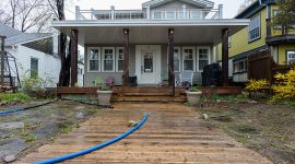
Parks vehicles run through flooded Cibola Ave, Trout Pond, Toronto Islands

Trout Running

A Parks vehicle runs a flooded-out section of Cibola.  This is the trout pond, which has completely flooded the road and almost made it to the lake proper to the south.  A couple of weeks earlier, and northern pike would have spawned in the baseball diamond.

Water floods the perimeter fence, Toronto City Center Airport, Toronto Islands

Airport Levels

The fields surrounding the perimeter fence of the Island airport are completely underwater.
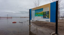
Beach underwater, Hanlan's Point, Toronto Islands

Blue Flag Beach

The beach at Hanlan’s Point is completely flooded out.


Flooded beach, Hanlan's Point, Toronto Islands

No Lifeguard On Duty

The beach at Hanlan’s Point, a shadow of its former self, now resembles a tidal pool or a thin sandbar peninsula.
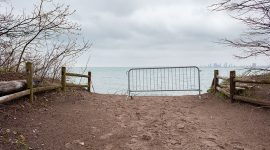
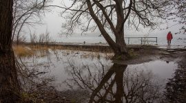
The trail ends in the lake, Gibraltar Point, Toronto Islands

Gibraltar Erosion

A trail on Gibraltar Point ends abruptly in a four foot drop directly into the lake.  Erosion along this shoreline is going to be absolutely massive when winds are out of the west.

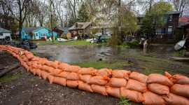
Working on the Bayview sandbag dike, Ward's Island, Toronto Island

Muddy Work

Parks workers continue the muddy task of building the protective sandbag dike on Bayview Ave.


Toronto Parks gator in front of 5 Channel Ave, Ward's Island, Toronto Islands

Beehive of Activity

The Island is an absolute beehive of activity, as Parks workers, heavy lifters and smaller gators move sandbags to and fro.

Ferry Ongiara and Bayview dike, Ward's Island, Toronto Islands

Sandbag Skyline

Ongiara sails past the sandbag dike on Bayview Ave.

Sandbags around 29 Third St., Ward's Island, Toronto Islands

29 Third St.

Sandbags line the perimeter of 29 Third St.


Sandbag dike on Bayview Ave., Ward's Island, Toronto Islands

Bayview Dike

Sandbags line the shoreline at Bayview and Sixth streets.

Bayview sandbag station, Ward's Island, Toronto Islands

Bayview Station

The impromptu sandbag station on Bayview Ave.

Drowned patio set, Ward's Island, Toronto Islands

Table For Two

A table waits for two in front of 2 Lenore Ave.


Pumps run at 22 Lakeshore, Ward's Island, Toronto Islands

22 Lakeshore

Hoses drain water from 22 Lakeshore.

Sinking eastern gap, Ward's Island, Toronto Islands

Disappearing Act

The remains of the eastern gap slide into the inner harbour.

Sandbag dike in the Cove, Ward's Island, Toronto Islands

Fortress Cove

The sandbag dike built to protect the Cove.


Sandbagging on Bayview, Ward's Island, Toronto Islands

Bagging Bayview

Sandbag operations begin on Bayview Ave. as the William Inglis sails past.

Evacuation of Artscape Gibraltar Point, Ward's Island, Toronto Islands

AGP Evacuation

Residents of Artscape Gibraltar Point are evacuated by bus to Ward’s dock.

Flooded Eastern gap, Ward's Island, Toronto Islands

Eastern Puddle

Flood waters rise on the inside of the Eastern gap hardened seawall.


Lake Ontario encroaches on 21 Third St., Ward's Island, Toronto Islands

21 Third St.

Flood waters encroach on the back of 21 Third St, just off of the Cove.

High water encroaches on the WIA, Ward's Island, Toronto Islands

WIA Encroachment

High water begins to encroach on the WIA during the Spring of 2017.

Flooded Bayview Ave, Ward's Island, Toronto Islands

Bayview Underwater

Bayview Ave. is flooded at Sixth St. by the high water levels.


First St beach underwater, Ward's Island, Toronto Islands

My Beach Was Gone

The beach between the Eastern Gap and First St is completely underwater, with the waterline advancing into the forest.

Waiting shed reflected in Lake Wards at dusk, Ward's Island, Toronto Islands

Waiting Shed

The Waiting Shed reflects in Lake Ward’s at dusk.

Ginger cat on fence, Ward's Island, Toronto Islands

High & Dry

One of the ginger six-toed cats stays high and dry on the fence leading to Ward’s Beach.


UA-1732909-7