
Lois M
After an epic journey from Nova Scotia’s south shore through the St. Lawrence, Lois M tows the new Commissioners St. bridge through the Eastern Gap. This is the western half of the bridge, weighing in at 650 tonnes and 83 metres long. Click either image to view larger.


Spare a Quarter?
A Bell phone booth sits at the water’s edge by Gibraltar Point under moody skies. Official Ontario provincial government satellite data shows the water 140 feet further out – a stark reminder of just how high the water levels are heading into 2020. Click image to view larger.

Pot O’Gold
A full rainbow arcs over Fifth St. after a brief, but intense, thunderstorm. Click image to view larger.

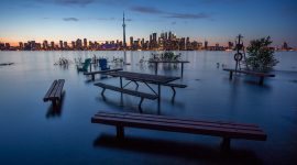
Waterworld
Floodwaters reflect trees and the skyline after sunset. This is the scene from the middle of Olympic Island, where the water was deep enough to kayak clear across the island. Click image to view larger.
The End
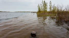
Floodwaters inundate the southeast corner of the Island. The Eastern Gap is completely underwater, and waves roll far inland through the wet meadow, to the bathrooms at the top of the soccer field.

Sandbag Stormclouds
Stormclouds roll over the sandbags lining the lagoon between the ferry docks and the water taxi landing.

235 Cibola
The lagoon floods Cibola during the Flood of 2019, creating a perfect reflecting pool for the new firehall.
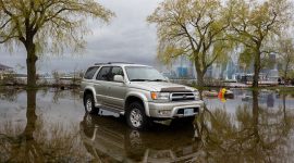
Lagoonside Parking
There’s always one: a truck sits in the floodwaters of 2019, just like this one in 2017. You could watch the water levels slowly drop by the algae marks on the tires.

Sandbag Seamus
Seamus walks past a sign entreating people to not walk on the sandbags lining Bayview Ave. They sure turn into a mess right quick if you do.


Black & Tan
Common garter snakes, one melanistic, emerge from their hibernaculum in the early Spring. Click image to view larger.

Balance of the Seasons
A mini glacier melts atop a groyne by the Centre Island pier. Click image to view larger.


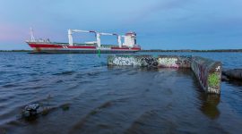
Last Bollard
Derrick barge T.H.C. 50 has completed her work removing the crumbling portion of the eastern gap. This panorama was shot on her last night moored just off of the cove. Click image to view larger.
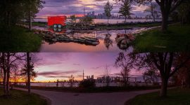
Seneca Pump Reinstated II
Seneca Ave after sunset during the Flood of 2017 and again in 2018. Click image to view larger.
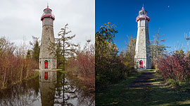
Gibraltar Reflections II
The Gibraltar Point light during the Flood of 2017 and again in 2018. Click image to view larger.

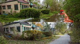
St. Andrew’s II
Cibola underwater, during and after the Flood of 2017, by the turnoff to St. Andrew’s By The Lake. Click image to view larger.
Bayview Ave II
Bayview Ave underwater during the Flood of 2017 and again in 2018. Click image to view larger.

Front Row Parking II
The parking lot by the Ward’s dock during and after the Flood of 2017. Click image to view larger.
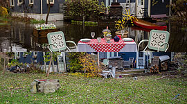
Table for Two II
Ken’s Table for Two during and after the Flood of 2017. Click image to view larger.